Map making is an ancient art, and a great deal of ingenuity has gone over the years into how you can draw the spherical surface of the Earth on a flat piece of paper in a way that still makes sense. That’s where all those map projections like Mercator’s come into play. More recently, to my dismay, I see in the media a much less sensible practice: drawing flat pieces of terrain onto a sphere.
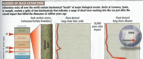
Consider this scan from an article in New Scientist, my favorite science magazine. Note the map at the right. Note how it takes you a disorienting moment to put it in context! At first glance, this is a sphere, hence it must be the earth; but what bizarre continent is it showing? Or is this some archaic proto-continent, long obliterated by continental drift?
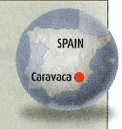
Of course after a second you register that it is Spain; but if so, what is it doing stretched across an entire hemisphere? You might explain the circle as simply a picture frame – nobody said a map must be rectangular – but if so, why the shading in and below the circle, clearly denoting a three-dimensional sphere?
The explanation is simple, and has to do with the ease and irresistible allure of doing special effects in Photoshop and its ilk, along with the paucity of common sense in the users of such tools. The map insert should have been left flat-shaded; the conflicting 3D cues (and the circle itself, for that matter) add only confusion.
Nor is this an isolated example; we see a lot of this sort of thing going around. Yuck!


0 Responses to “Why Photoshop and Mapmaking don’t mix”